Bagini Glacier Trek Guide: The "Changabang" Base Camp Expedition
📍The Mighty Himalayas (North India)
The Summit Summary
- Location: Uttarakhand (Chamoli District, Garhwal Himalayas).
- The Vibe: A "Mountaineer’s Pilgrimage." This is not a lush meadow walk; it is a raw, rugged journey into the heart of the Nanda Devi Sanctuary's outer wall. You walk on glacial moraines, surrounded by giants like Changabang, Dunagiri, and Kalanka.
- Difficulty: Moderate to Difficult. The challenge lies in the terrain (loose rocks, glacial debris) and the altitude (touching 14,816 ft).
- Duration & Variants: 5-6 Days (Trek Duration); 8-9 Days (Standard Itinerary). 43 km Total Distance.
- TrippinAI Recommended Slot: May to June (Pre-monsoon for snow bridges) or September to October (Post-monsoon for crystal clear views of the peaks).
- The TrippinAI Rating: "At TrippinAI, we rate this trek a 6.5/10 on endurance (due to long days of navigating unstable moraine and steep ascents near Changabang Base Camp)."
The Climb: What to Expect
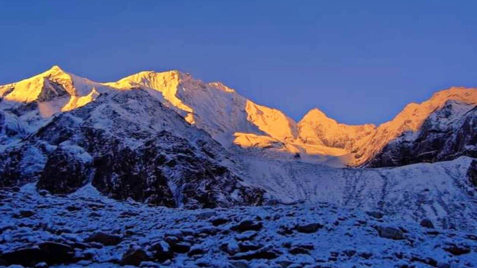
The Reality Check: The trek to Bagini Glacier feels like stepping into a high-altitude amphitheater. It begins in the wind-swept Niti Valley at Jumma, climbing sharply to the legendary Dronagiri Village—a place steeped in mythology and devoid of electricity in winter. As you push past the Longatulli campsite, the greenery vanishes. You enter a world of grey granite and white ice. The walk on the Bagini Glacier itself is a test of balance, navigating crevasses and boulder fields. But the climax at Changabang Base Camp is spiritual—you stand directly beneath the vertical, shark-tooth rock face of Mt. Changabang, glowing silver in the moonlight. It is one of the most intimidating and beautiful rock faces in the Himalayas.
Why It's Famous & What Trekkers Say
The Fame Check:
- The "Hanuman" Connection: The trek passes through Dronagiri Village. Locals believe this is the exact mountain from which Lord Hanuman lifted the Sanjeevani Booti (life-saving herb) in the Ramayana. The villagers, interestingly, do not worship Hanuman because he "stole" their mountain.
- The "Shining Mountain": It offers the closest look at Mt. Changabang (6,864m) and Mt. Kalanka. Changabang is famous in mountaineering circles for its sheer granite walls, often compared to peaks in Patagonia.
The Social Pulse:
- The Good (What Trekkers Love): The isolation. Unlike Kedarkantha or Har Ki Dun, you might be the only group on this trail. The starry skies at the Advanced Base Camp are rated among the best in India.
- The Bad (What Trekkers Hate): The moraine walk. Walking on loose rocks for hours is tiring for the ankles. The lack of water sources between Dronagiri Village and Longatulli is a common complaint.
The Trail: Milestones & Route Map
The Route Breakdown:
- Jumma: Road Head (Start Point). The Highlight: The drive from Joshimath ends here. A dusty, windy gorge where the trek begins.
- Ruing Village: Day 1 Camp. The Highlight: A small settlement with terraced fields. A good warm-up for the legs.
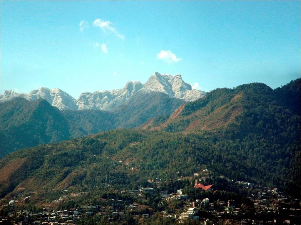
- Dronagiri Village: Day 2 Camp (11,800 ft). The Highlight: The mythological village. It is uninhabited in winter. The views of Hathi Parbat from here are stunning.
- Bagini Base Camp: Day 4 Camp (14,816 ft). The Highlight: You camp on the grassy banks of the glacial stream, surrounded by snow peaks.
- Changabang Base Camp: Day 5 (Excursion). The Highlight: The turnaround point. Standing at the foot of Changabang and Kalanka.
- Rishi Kund: Detour. The Highlight: A high-altitude lake often visited if time permits.
How to Reach (The Gateway Hubs)
The Navigation Breakdown:
- State: Uttarakhand.
- Gateway Hub: Rishikesh / Haridwar.
- Base Hub: Joshimath (256 km from Rishikesh).
- Start Point: Jumma (45 km drive from Joshimath on the Malari Highway).
- By Air: Fly to Jolly Grant Airport (Dehradun).
- By Road: Drive Rishikesh -> Joshimath -> Jumma.
The TrippinAI Verdict:
- Most Cost Efficient: Govt. Bus from Rishikesh to Joshimath (~INR 700). Then Shared Sumo to Jumma (~INR 150).
- Most Time Efficient: Private Cab from Dehradun Airport to Joshimath. Cost: ~INR 7,000 - 9,000.
- Most Popular: Trek packages usually arrange pickup from Rishikesh to Joshimath.
Total Budget & Hidden Costs
The Wallet Damage:
- TrippinAI Budget Rating: Mid-Range.
- Permits: Entry Fee Required. Nanda Devi Biosphere / Forest Department permits are needed (obtainable in Joshimath).
- Trek Package: Expect INR 14,000 - 18,000 per person. The logistics are harder due to the remote location.
- Transport: Budget extra INR 3,000 for the Joshimath-Jumma-Joshimath sector if not included.
Smart Spending Hacks:
- Hack #1: Stay in Dronagiri Homestays. Instead of carrying heavy tents for the lower camps, pay locals in Dronagiri village to stay in their unused summer homes (if open). It supports the economy and saves weight.
- Hack #2: Bulk Buy in Joshimath. There are no shops after Jumma. Buy all chocolates, batteries, and meds in Joshimath. Prices at Ruing (if available) are 3x.
- "Use TrippinAI for more accurate and personalized information on costs."
Food & Local Legends
Context:
- The Flavor: The Bhotiya community inhabits this valley. Try Jhangora ki Kheer (Barnyard millet pudding) or Butter Tea if you get invited into a local home.
- Local Insight: The Dronagiri villagers have a unique custom—they shun the worship of Hanuman. While the rest of India venerates him, here he is seen as the destroyer of their sacred mountain's right flank.
Seasonality, Safety & Health
Best Time to Visit:
- Summer (May-June): The glacier is stable, and the flowers in the lower valleys are blooming.
- Autumn (Sept-Oct): The air is crisp, offering the best visibility for the peaks.
- Avoid:Monsoon (July-August). The road to Jumma (Joshimath-Malari) is notorious for landslides and road blocks.
Traveler Safety Verdict:
- For Solo Travelers: Not Recommended. The trail on the glacier is tricky and unmarked. Crevasses can be hidden under snow.
- For Female Travelers: Safe in Groups. The region is remote but safe. Stick to organized operators.
- For Beginners: No. This trek requires previous high-altitude experience. The altitude gain is significant, and the terrain is rough.
Risks & Actionable Mitigation:
- Falling Rocks: The trail from Ruing to Dronagiri has landslide-prone sections. Mitigation: Speed Up. Do not stop for photos in landslide zones. Watch for falling dust (a sign of rocks coming down).
- Glacial Crevasses: Walking on the Bagini glacier requires caution. Mitigation: Follow the Guide. Never veer off the established path on the ice.
- "Check TrippinAI for real-time weather updates."
Getting Trek-Ready
Preparation Tips:
- Ankle Strength: The moraine (loose rocks) will twist your ankles if they are weak. Do single-leg balances and calf raises.
- Acclimatization: Spend a day in Joshimath before heading to Jumma. Dronagiri village is already at 11,800 ft, so the jump is high.
- Navigation: Download offline maps. The trail disappears often in the boulder fields.
Expedition Essentials
- Footwear: High-Ankle Boots. Low-cut shoes will fill with grit and offer no protection against ankle rolls on the moraine.
- The "Hero" Item: Wide-Brimmed Hat. The sun in the Niti Valley is harsh and direct.
- Clothing: Down Jacket. Temps at Base Camp drop to -5°C even in June.
FAQ: Trekker's Most Asked Questions
Q: Is this trek crowded? A: No. It is one of the least crowded treks in Garhwal. You might find solitude for days, unlike the queues at Kedarkantha.
Q: Can I see Nanda Devi? A: No, Nanda Devi itself is hidden by the sanctuary wall. However, you see its "Outer Wall" guardians—Dunagiri, Changabang, and Kalanka—which are equally majestic.
Q: Is there mobile network? A: Zero. The last signal is near Joshimath. Inform your family that you will be off the grid for 6-7 days.
Planning Bagini Glacier? The Malari highway permissions can change based on military movements near the border. Static blogs won't update you. TrippinAI provides real-time permit status and logistics alerts. [Check Border Road Status Now.]
Recommended for You
Namdapha Rainforest Trek Guide: The "Amazon of India" & The Four Cat Realm
Japfu Peak Trek Guide: The "Rhododendron Giant" & Valley Watchtower