David Scott Trail Guide: The "British Trade Route" & Khasi History Walk
📍The Mighty Himalayas (North India)
The Summit Summary
- Location: Meghalaya (Connects Mawphlang to Lad Mawphlang).
- The Vibe: A "Time-Travel" Trek. This isn't just a walk through nature; it's a journey through history. You are walking on a path laid down in the early 1800s by a British administrator, David Scott. One moment you are crossing a modern steel suspension bridge, and the next you are walking on ancient cobblestones laid by Khasi laborers two centuries ago. It blends the haunting silence of sacred groves with the pastoral beauty of rolling river valleys.
- Difficulty: Easy to Moderate. The trail is mostly downhill or flat if you start from Mawphlang. The total altitude change is gentle, making it accessible for beginners and families.
- Duration & Variants: 1 Day (4-6 Hours). 16 km Total Distance (Point-to-Point).
- TrippinAI Recommended Slot: October to April. The dry months are best. In monsoon (June-Sept), the trail becomes a slippery mud-fest, though the waterfalls are spectacular.
- The TrippinAI Rating: "At TrippinAI, we rate this trek a 3/10 on endurance. It is a 'Sunday Hike' for the fit, but the length (16 km) can be tiring for those unused to walking long distances."
The Climb: What to Expect
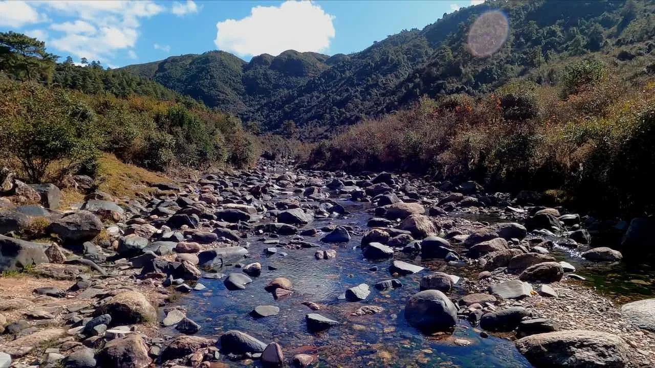
The Reality Check: The trek is a linear traverse, not a loop. It usually begins at Mawphlang, right next to the famous Sacred Grove. The trail starts with a winding descent through a dirt track that opens up into the broad valley of the Umiam River. You walk past Khasi gravestones, including a tomb from 1843, and cross a hanging bridge over the crystal-clear river. The middle section is a flat, scenic walk through the Wah Tham valley, flanked by green hills that look remarkably like the Scottish Highlands. The final push involves a gradual uphill climb to Lad Mawphlang (near Sohra/Cherrapunji), passing the quaint village of Laithsohma.
Why It's Famous & What Trekkers Say
The Fame Check:
- The "Colonial" Connection: It is one of the oldest trekking routes in India, originally a mule track connecting Assam to Sylhet (now in Bangladesh).
- The "Sacred" Start: It starts at the Mawphlang Sacred Grove, a protected forest where locals believe a deity resides. Taking even a leaf or pebble from the grove is strictly forbidden and said to bring bad luck.
The Social Pulse:
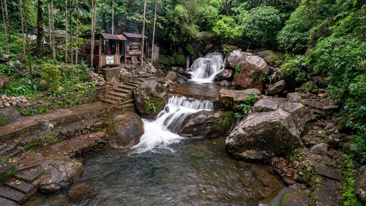
- The Good (What Trekkers Love): The river crossing. The suspension bridge over the Umiam River is the most photographed spot. The "Umiam Valley" section is often described as therapeutic due to its absolute silence and rolling green meadows.
- The Bad (What Trekkers Hate): The end logistics. Since you finish at Lad Mawphlang (20 km away from where you started), finding a cab back to Shillong can be a nightmare if not pre-arranged. The trail can be infested with leeches during rains.
The Trail: Milestones & Route Map
The Route Breakdown (Chronological):
- Mawphlang: Start Point (5,900 ft). The Highlight: The Sacred Grove entrance. A quick visit to the grove before the trek is highly recommended.
- Ka Kor Shon Mai: Rest Point. The Highlight: The first resting bench. From here, you get the first sweeping view of the Umiam valley.
- Camilla's Tomb: Historical Marker. The Highlight: A solitary tomb of a child named Camilla, dated 1843, reminding you of the trail's colonial past.
- Suspension Bridge: The Crossing. The Highlight: A steel hanging bridge over the Umiam River. The water below is often clear enough to see the riverbed.
- Laithsohma Village: Mid-Point. The Highlight: A tiny hamlet where you can buy tea, Maggi, and pineapples from local villagers.
- Lad Mawphlang: End Point. The Highlight: The exit gate. This opens onto the main road leading to Cherrapunji.
How to Reach (The Gateway Hubs)
The Navigation Breakdown:
- State: Meghalaya.
- Gateway Hub: Guwahati / Shillong.
- Start Point: Mawphlang (25 km from Shillong).
- End Point: Lad Mawphlang (near Cherrapunji).
- By Air: Fly to Guwahati Airport (GAU) or Shillong Airport (SHL).
The TrippinAI Verdict:
- Most Cost Efficient: Shared Sumo from Shillong (Bara Bazar) to Mawphlang (~INR 50-70). Warning: Finding a shared cab back from the end point (Lad Mawphlang) is very difficult.
- Most Time Efficient: Private Cab from Shillong. Drop at Mawphlang and pick up at Lad Mawphlang. Cost: ~INR 2,500 - 3,500.
- Logistics Note: Since the start and end points are different, driving your own car/bike is tricky unless you hike back the same way (32 km total), which is not recommended.
Total Budget & Hidden Costs
The Wallet Damage:
- TrippinAI Budget Rating: Budget-Friendly.
- Permits: No Permit Required, but a guide is often mandatory or strongly encouraged by the local village council.
- Entry Fee: ~INR 50-100 per person at the Mawphlang entrance.
- Guide Fee: Expect to pay INR 1,200 - 1,500 for a local guide (for a group).
- Trek Package: Tour operators charge INR 2,500 - 4,000 per person (includes transport and guide).
Smart Spending Hacks:
- Hack #1: Use Local Guides. Do not book expensive online packages. Hire a guide directly at the Mawphlang parking lot. It supports the locals directly and is cheaper.
- Hack #2: Hitchhike the End. If you finish at Lad Mawphlang without a cab, stand on the main road and flag down a shared Sumo coming from Cherrapunji to Shillong. It might be crowded, but it costs only INR 100.
- "Use TrippinAI for more accurate and personalized information on costs."
Food & Local Legends
Context:
- The Flavor: At Laithsohma village (mid-trail), try the fresh pineapples or cucumbers sold by locals. They are incredibly sweet. Pack a lunch; there are no restaurants on the trail.
- Local Insight: The Umiam River is said to be formed by the tears of two sisters who came down from heaven. One sister got lost, and the other's tears created the river. Locals consider the river crossing sacred.
Seasonality, Safety & Health
Best Time to Visit:
- Oct-April: Best Window. Dry trails, clear blue skies, and pleasant sun.
- May-June: Pre-Monsoon. Greenest landscape, but high chance of rain.
- Avoid: Heavy Monsoon (July-Aug). The trail turns into a muddy slip-n-slide, and the Umiam river can swell dangerously.
Traveler Safety Verdict:
- For Solo Travelers: Safe. The trail is well-marked and popular.
- For Female Travelers: High Safety. Meghalaya is a matrilineal society and is very safe for women.
- For Beginners: Top Pick. The perfect introductory trek for anyone visiting the North East.
Risks & Actionable Mitigation:
- Slippery Rocks: The cobblestones near the suspension bridge are mossy and slick. Mitigation: Good Grip Shoes. Do not wear flat sneakers or Converse. Wear shoes with deep treads.
- Getting Lost: There are a few diverging paths near Laithsohma. Mitigation: Hire a Guide. The trail isn't always signposted. A guide ensures you don't end up in a random farm.
- "Check TrippinAI for real-time weather updates."
Getting Trek-Ready
Preparation Tips:
- Water: Carry at least 2 liters. There are no safe drinking water sources until Laithsohma.
- Sun Protection: The middle section (Wah Tham valley) is open with no shade. Wear a hat.
- Network: Jio/Airtel work at the start and end, but signal is dead in the valley floor.
Expedition Essentials
- Footwear: Trail Running Shoes or Hiking Boots.
- The "Hero" Item: Salt/Tobacco. If trekking in wet months, carry salt to remove leeches.
- Clothing:Light Cotton (if sunny) or Poncho (if cloudy). Weather changes fast.
FAQ: Trekker's Most Asked Questions
Q: Can I cycle the trail? A: Yes. It is a popular mountain biking trail. However, some rocky sections require you to carry your bike.
Q: Is the Sacred Grove part of the trek? A: No. The Sacred Grove is a separate walk right next to the starting point. It takes an extra 45 mins to explore. Do it before starting the trek.
Q: Can I swim in the river? A: Yes, near the suspension bridge. But be careful of the currents, especially during monsoons.
Planning David Scott? If you plan to visit the Sacred Grove before the trek, ensure you reach Mawphlang by 8:00 AM. The Grove tour takes time, and you don't want to start the main trek late. TrippinAI provides combo-tour itineraries for culture + adventure. [Check Itineraries Now.]
Recommended for You
Namdapha Rainforest Trek Guide: The "Amazon of India" & The Four Cat Realm
Japfu Peak Trek Guide: The "Rhododendron Giant" & Valley Watchtower