Lamkhaga Pass Trek Guide: The "Forbidden" Crossover
The Summit Summary
- Location: Himachal Pradesh to Uttarakhand (Connects Chitkul in Kinnaur to Harsil in Gangotri Valley).
- The Vibe: A "Ghost Trail." This is widely considered one of the toughest and most remote treks in the Indian Himalayas. You walk from the last village of India (Chitkul) into a no-man's-land of snow, ice, and jagged ridges, emerging days later in the holy land of Gangotri.
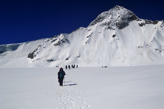
- Difficulty: Difficult / Technical. This is an expedition, not a trek. It involves traversing long glaciers, navigating crevasses, and crossing a high-altitude pass at 17,320 ft that is often buried in deep snow.
- Duration & Variants: 8-9 Days (Standard Itinerary). 70 km Total Distance.
- TrippinAI Recommended Slot: May to June (Pre-monsoon) or September to Mid-October (Post-monsoon). The pass is inaccessible in winter and dangerous during peak monsoon.
- The TrippinAI Rating: "At TrippinAI, we rate this trek a 9/10 on endurance and technical skill. It requires permits from the District Magistrate (DM) and ITBP due to its proximity to the Indo-China border."
The Climb: What to Expect
The Reality Check: Lamkhaga Pass is beautiful but unforgiving. The journey starts in the picturesque village of Chitkul (11,320 ft), known for its potatoes and wooden houses. The trail follows the Baspa River into the wild, leaving civilization behind at the ITBP checkpost. The terrain shifts rapidly from green meadows to infinite moraines (glacial debris). The climb to the pass is a test of nerves—a steep, near-vertical ascent on snow and ice. At the top, you straddle the border of two states. The descent into the Jalandhari Gad river valley on the Uttarakhand side is equally brutal, involving tricky river crossings and boulder hopping before reaching the serene pine forests of Harsil.
Why It's Famous & What Trekkers Say
The Fame Check:
- The "Border" Thrill: The trek runs parallel to the Indo-Tibetan border. The heavy military presence and strict permit requirements add an aura of exclusivity and seriousness to the adventure.
- The "Kinnaur-Garhwal" Link: It is an ancient trade route used by shepherds to barter salt and wool between the cultures of Kinnaur and Garhwal, now abandoned by all except hardcore trekkers.
The Social Pulse:
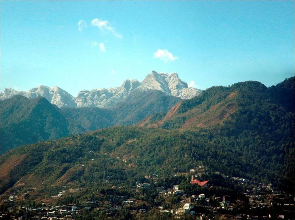
- The Good (What Trekkers Love): The raw isolation. You are truly "off the map." The transition from the dry, rocky Kinnaur terrain to the lush, green Gangotri valley is a geographical marvel.
- The Bad (What Trekkers Hate): The permits. Getting the Inner Line Permit (ILP) can be a bureaucratic nightmare involving multiple offices (Shimla/Reckong Peo). The glacial traverse is exhausting and dangerous without crampons.
The Trail: Milestones & Route Map
The Route Breakdown:
- Chitkul: Start Point (11,320 ft). The Highlight: "India's Last Village." Enjoy the final comfortable bed and meal here.
- Rani Kanda: Day 2 Camp (12,100 ft). The Highlight: A vast meadow that serves as the grazing ground for Chitkul's livestock.
- Dumti: Day 3 Camp (13,300 ft). The Highlight: The ITBP checkpost. This is where your permits are scrutinized. The landscape turns barren.
- Gundar: Day 4 Camp (14,500 ft). The Highlight: The base of the pass. You camp on glacial moraine, surrounded by silence and snow.
- Lamkhaga Pass Base Camp: High Camp (15,700 ft). The Highlight: The launchpad. You sleep on the glacier, preparing for a midnight start.
- Lamkhaga Pass: Summit Day (17,320 ft).The Highlight: The crossover. A sharp ridge offering views of the surrounding 6,000m peaks.
- Kyarkoti: Descent Camp (Uttarakhand). The Highlight: The first sign of greenery (Bhojpatra trees) and beautiful alpine lakes after the pass.
- Harsil: End Point (8,600 ft). The Highlight: The apple orchards of Harsil and the Bhagirathi River.
How to Reach (The Gateway Hubs)
The Navigation Breakdown:
- State: Himachal Pradesh (Start) / Uttarakhand (End).
- Start Hub: Shimla -> Reckong Peo -> Chitkul.
- End Hub: Harsil -> Uttarkashi -> Dehradun.
- By Air: Fly to Chandigarh (for Shimla start). Fly out of Dehradun (Jolly Grant).
- By Bus: Bus from Shimla to Reckong Peo, then local bus/taxi to Chitkul.
The TrippinAI Verdict:
- Most Cost Efficient: HRTC Bus network from Chandigarh to Chitkul (via Reckong Peo). Return via Bus from Harsil to Dehradun.
- Most Time Efficient: Private Cab for the entire Shimla-Chitkul leg. (Warning: It is a long 2-day drive).
- Logistics Note: This is a crossover trek. You must arrange for transport to pick you up at Harsil, or rely on local jeeps to Uttarkashi.
Total Budget & Hidden Costs
The Wallet Damage:
- TrippinAI Budget Rating: High / Expedition Grade.
- Permits: Expensive & Mandatory. Inner Line Permits (ILP) and Wildlife fees apply.
- Trek Package: Expect INR 30,000 - 45,000 per person. The high cost covers specialized guides, high-altitude porters (mules cannot cross the pass easily), and permit processing fees.
- Transport: The return journey from Harsil to Dehradun is another INR 4,000 (Private Cab) or INR 500 (Shared).
Smart Spending Hacks:
- Hack #1: Apply for Permits Early. Agents charge a premium for "express" permits. Apply 30 days in advance through the SDM office in Reckong Peo to save agent fees.
- Hack #2: Group Size Matters. Permit fees and guide costs are fixed. A group of 6-8 trekkers drastically reduces the per-head cost compared to a group of 2.
- "Use TrippinAI for more accurate and personalized information on costs."
Food & Local Legends
Context:
- The Flavor: In Chitkul, eat at the "Hindustan Ka Aakhri Dhaba" (Last Dhaba of India). In Harsil, try the famous Harsil Apples (introduced by British settler Frederick Wilson).
- Local Insight: Locals believe the pass is guarded by spirits. The weather can turn instantly if one is disrespectful (shouting or littering) on the glacier. The Jalandhari Gad river is named after Jalandhara, a demon mentioned in the Puranas.
Seasonality, Safety & Health
Best Time to Visit:
- May-June: Good snow cover makes walking on the glacier easier (crampons required).
- Sept-Oct: The snow melts, revealing crevasses. Navigation becomes technical, but visibility is excellent.
- Avoid: July-August (Monsoon). Avalanches and landslides are frequent. Winter is strictly closed.
Traveler Safety Verdict:
- For Solo Travelers: Illegal & Suicidal. You will not get a permit solo. You must be a team of at least 2-4 with a registered guide.
- For Female Travelers: Safe in Professional Expeditions. Ensure you go with a reputed agency that provides proper toilet tents and experienced staff.
- For Beginners: Forbidden. This trek requires knowledge of rope-up procedures and high-altitude survival.
Risks & Actionable Mitigation:
- Crevasses: The glacier on the Gundar side has hidden cracks. Mitigation: Rope Up. Always traverse the snowfield roped to your guide. Use a walking stick/ice axe to probe the snow.
- Permit Rejection: Trekkers are often turned back at Dumti for improper paperwork. Mitigation: Triple Check Documents. Ensure your ID proofs, photos, and medical certificates match exactly what was submitted for the permit.
- "Check TrippinAI for real-time weather updates."
Getting Trek-Ready
Preparation Tips:
- Technical Gear: Learn how to use Crampons and Gaiters. You will wear them for 2-3 days straight.
- Endurance: Ruck with 15kg for 10km. Your porters might struggle on the pass, so be ready to carry your own daypack + emergency gear.
- Communication: No signal for 6 days. Carry a Satellite Phone (with permission) or relying on the guide's radio is the only option.
Expedition Essentials
- Footwear: Stiff Mountaineering Boots (B2/B3 rated). Flexible trekking shoes are dangerous on steep ice.
- The "Hero" Item: High-Altitude Goggles. Snow blindness is a major risk on the long glacier walk.
- Clothing: Waterproof Pants. You will be sliding/kneeling in snow often.
FAQ: Trekker's Most Asked Questions
Q: Is Lamkhaga harder than Pin Parvati? A: Yes. Lamkhaga is more technical (steep ice/snow ascent) and higher in altitude (17,320 ft vs 17,450 ft, but the ascent angle is sharper).
Q: Can I start from Harsil (Reverse)? A: Yes, but it is not recommended. The ascent from Harsil is steeper and rapid, leading to higher chances of AMS. The Chitkul start allows better acclimatization.
Q: How long does the permit take? A: It can take 2-3 days on the ground in Reckong Peo or Shimla. Most agencies handle this beforehand if you send documents early.
Planning Lamkhaga Pass? Border tensions or heavy snow can lead to sudden permit cancellations by the ITBP. Static blogs won't alert you. TrippinAI provides real-time permit status and border opening alerts. [Check Permit Status Now.]
Recommended for You
Namdapha Rainforest Trek Guide: The "Amazon of India" & The Four Cat Realm
Japfu Peak Trek Guide: The "Rhododendron Giant" & Valley Watchtower