Pangarchulla Peak Trek Guide: The "Mini-Mountaineering" Expedition
📍The Mighty Himalayas (North India)
The Summit Summary
- Location: Uttarakhand (Chamoli District, Joshimath Region).
- The Vibe: A "Gateway to Mountaineering." This is not a hike; it is a summit climb. It bridges the gap between trekking and technical climbing, involving boulder navigation, steep snow ridges, and a summit push that tests your grit.
- Difficulty: Difficult. Significantly harder than Kuari Pass or Kedarkantha. The summit day is long (12-14 hours) and physically draining.
- Duration & Variants: 6-7 Days (Standard Itinerary). 38 km Total Distance.
- TrippinAI Recommended Slot: April to May (Spring). This is the "Golden Window" when the peak is covered in snow, making it climbable. In post-monsoon (Autumn), the snow melts, leaving a dangerous, loose boulder field that is often unclimbable.
- The TrippinAI Rating: "At TrippinAI, we rate this trek a 7/10 on endurance and technicality (due to the steep ridge ascent at 15,069 ft and the need for ropes/crampons in sections)."
The Climb: What to Expect
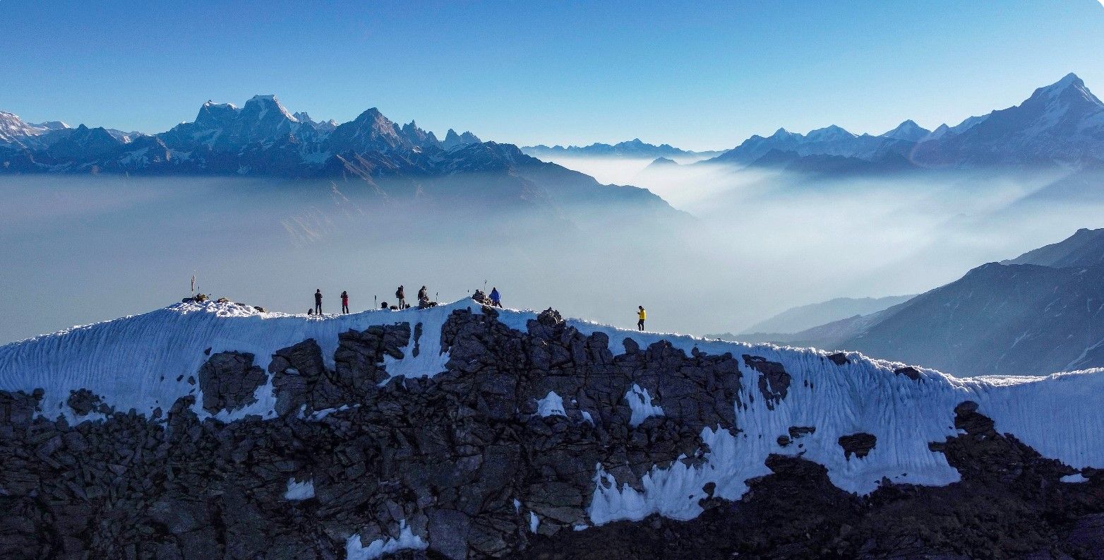
The Reality Check: Pangarchulla is a shapeshifter. The first three days deceive you with the pleasant, oak-shaded trails of the Kuari Pass route (Guling and Khullara). But on summit day, the beast wakes up. Leaving camp at 2:00 AM under a canopy of stars, you ascend onto the ridge. The terrain shifts from grass to endless snowfields (in spring). The final 1,000 feet are a test of willpower—a knife-edge ridge where you walk with a sheer drop on both sides, battling wind gusts, until you reach the small rocky summit. The reward? You are standing right in the lap of the Nanda Devi Sanctuary, with Nanda Devi, Kamet, Mana, and Hathi-Ghoda peaks forming a 360-degree fortress around you.
Why It's Famous & What Trekkers Say
The Fame Check:
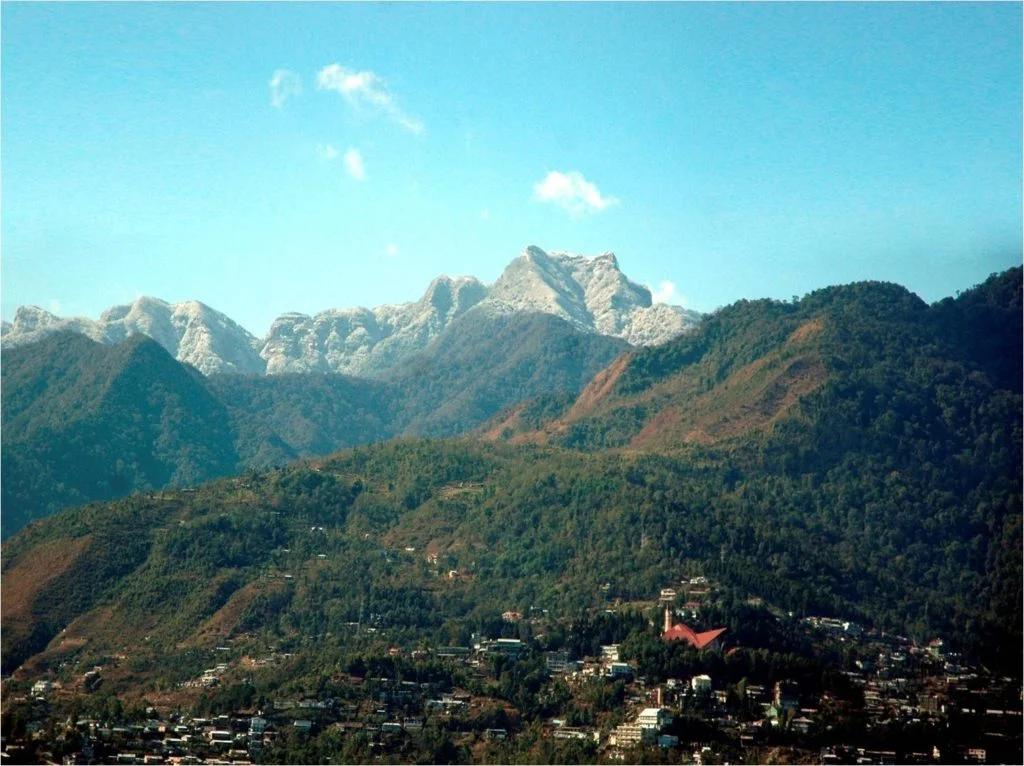
- The "Chimney" Effect: It is famous for its close-up views of Mt. Nanda Devi (7,816m). While Kuari Pass sees it from a distance, Pangarchulla feels like you are climbing alongside it.
- The "First Summit" Badge: For many Indian trekkers, this is their first trek that crosses the 15,000 ft mark and involves a proper "Summit Push" rather than just crossing a pass.
The Social Pulse:
- The Good (What Trekkers Love): The adrenaline of the ridge walk. The sunrise hitting Nanda Devi while you are mid-climb. The pristine campsites of Khullara.
- The Bad (What Trekkers Hate): The "False Summits." Trekkers often complain that the peak looks close but keeps receding. The summit success rate is volatile; bad weather turns groups back frequently.
The Trail: Milestones & Route Map
The Route Breakdown:
- Dhak Village: Start Point (6,900 ft). The Highlight: The drive from Joshimath ends here. You start walking through dusty trails that quickly turn into farming terraces.
- Guling: Day 2 Camp (9,600 ft). The Highlight: A dense oak forest campsite. It’s warm, cozy, and perfect for acclimatization.
- Khullara: Base Camp (11,100 ft). The Highlight: The launchpad. An open meadow facing Dronagiri peak. This is where you prepare for the summit (crampon fitting, gaiter checks).
- Pangarchulla Peak: Summit Day (15,069 ft). The Highlight: The climb involves navigating the "Rawat Gher" (boulder zone) and the final snow ridge.
- Auli: Descent Point. The Highlight: The trek often ends via the Tali forest route, emerging at the famous ski slopes of Auli.
How to Reach (The Gateway Hubs)
The Navigation Breakdown:
- State: Uttarakhand.
- Gateway Hub: Rishikesh / Haridwar.
- Base Hub: Joshimath (256 km from Rishikesh).
- By Air: Fly to Jolly Grant Airport (Dehradun).
- By Road: Rishikesh to Joshimath is a 9-10 hour drive via the Badrinath Highway (NH-7).
The TrippinAI Verdict:
- Most Cost Efficient: Govt. Bus (Rodways) from Rishikesh to Joshimath. Leaves at 5:00 AM. Cost: ~INR 600-700.
- Most Time Efficient: Private Cab from Dehradun Airport to Joshimath. Cost: ~INR 7,000 - 9,000.
- Most Popular: Shared Tata Sumo from Rishikesh (Natraj Chowk). Cost: ~INR 1,000 - 1,200 per seat.
Total Budget & Hidden Costs
The Wallet Damage:
- TrippinAI Budget Rating: Mid-Range to Premium.
- Permits: Entry Fee Required. Nanda Devi Biosphere Reserve fees apply.
- Trek Package: Expect INR 13,000 - 18,000 per person. This is higher than Kuari Pass because it requires technical guides, ropes, and safety equipment for the summit.
- Transport: Budget an extra INR 2,500 for round-trip transport from Rishikesh if not included.
Smart Spending Hacks:
- Hack #1: Combine with Kuari Pass. Since both treks share the same initial route (Dhak-Khullara), some operators offer a combo. You do Kuari Pass on Day 4 and Pangarchulla Summit on Day 5. It costs only ~INR 3,000 more than doing just one.
- Hack #2:Stay at Joshimath Homestays. Avoid the expensive hotels near the market. Look for homestays in Upper Joshimath or Sunil Village. Save INR 800/night.
- "Use TrippinAI for more accurate and personalized information on costs."
Food & Local Legends
Context:
- The Flavor: Energy bars are your best friend on summit day. In Joshimath, eat at the local dhabas serving Aloo Ke Gutke (spiced potatoes) and Gehat Ki Dal.
- Local Insight: The peak is named after the "Pangar" tree (Horse Chestnut) which grows in the lower forests. Locals consider the Nanda Devi Sanctuary holy territory; loud noises and swearing are discouraged on the summit approach.
Seasonality, Safety & Health
Best Time to Visit:
- Spring (April-May): The Best Time. The boulders are covered in firm snow, making the climb easier and safer.
- Winter (Dec-Feb): Too much soft snow makes the approach impossible.
- Autumn (Oct-Nov): The snow melts, exposing loose rocks. The "boulder hopping" becomes dangerous and ankle-breaking. Avoid if you are a beginner.
Traveler Safety Verdict:
- For Solo Travelers: Not Recommended. This is a semi-technical climb. You need a team and a guide for the summit push.
- For Female Travelers: Safe in Groups. Organized operators run this route frequently in spring.
- For Beginners: No. Do Kuari Pass or Kedarkantha first. This requires high cardiovascular endurance (12 hours of walking) and mental toughness.
Risks & Actionable Mitigation:
- Altitude Sickness (AMS): You jump from 11,000 ft (Camp) to 15,000 ft (Summit) and back in one day. Mitigation: Hydrate & Acclimatize. Spend an extra active day at Khullara if possible. If you have a headache at 13,000 ft, turn back immediately.
- Sun Glare: The snow blindness risk is extreme on the ridge. Mitigation: Wrap-around Sunglasses. Regular wayfarers let light in from the sides. Use UV-protected sports glasses.
- "Check TrippinAI for real-time weather updates."
Getting Trek-Ready
Preparation Tips:
- Interval Training: The final climb is steep. Do sprint intervals (run 1 min, walk 2 mins) to build explosive lung capacity.
- Balance Training: Yoga (Tree Pose, Warrior III) helps. You will be walking on narrow ridges and uneven boulders.
- Gear Check: Ensure your boots have been broken in. A blister on summit day is a trek-ender.
Expedition Essentials
- Footwear: Stiff Trekking Boots. Flexible running shoes are dangerous here; you need a stiff sole to kick steps into the snow.
- The "Hero" Item: Gaiters. You will be knee-deep in snow on summit day. Gaiters prevent snow from entering your boots.
- Clothing: Waterproof Pants. You might need to slide (glissade) down sections during the descent.
FAQ: Trekker's Most Asked Questions
Q: Do I need ropes for Pangarchulla? A: Usually, yes. Guides will fix a safety rope on the final ridge section if the snow is icy or the wind is high. You will be harnessed or hold onto the rope for safety.
Q: Is it harder than Roopkund? A: Physically, yes. The summit day on Pangarchulla is more grueling and steeper than the climb to Roopkund lake.
Q: Can I see the summit from the base camp? A: Yes, Khullara offers a view of the peak, which helps in mentally preparing for the route the night before.
Planning Pangarchulla? The snow line changes rapidly in April. Static blogs can't tell you if the summit route is open or blocked by soft snow. TrippinAI provides real-time summit success rates and personalized itineraries. [Check Summit Status Now.]
Recommended for You
Namdapha Rainforest Trek Guide: The "Amazon of India" & The Four Cat Realm
Japfu Peak Trek Guide: The "Rhododendron Giant" & Valley Watchtower