Pin Parvati Pass Trek Guide: The Ultimate "Trans-Himalayan" Expedition
📍The Mighty Himalayas (North India)
The Summit Summary
- Location: Himachal Pradesh (Connects the lush Parvati Valley in Kullu to the barren Pin Valley in Spiti).
- The Vibe: The "Big Daddy" of crossovers. This is not just a trek; it is an expedition that demands respect. You walk through dense rainforests, cross wild un-bridged rivers, navigate crevassed glaciers, and emerge into a high-altitude cold desert.
- Difficulty: Difficult / Technical. Reserved for seasoned trekkers only. The trails are broken, the navigation is tricky, and the pass crossing involves negotiating live glaciers.
- Duration & Variants: 9-11 Days (Standard Itinerary). 110 km Total Distance.
- TrippinAI Recommended Slot: July to August (Monsoon). Paradoxically, this is the best time because the Spiti side is dry, and the Parvati side is lush (though rainy). The pass is usually unclimbable in other months due to heavy snow.
- The TrippinAI Rating: "At TrippinAI, we rate this trek a 9/10 on endurance and risk (due to the precarious crossing of the Parvati River via pulley bridges and the high probability of hidden crevasses on the pass)."
The Climb: What to Expect
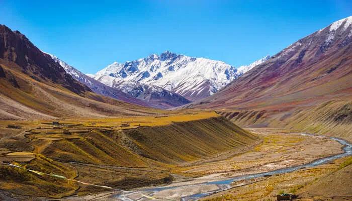
The Reality Check: Pin Parvati is a journey of extremes. It starts in Barshaini (near Kasol), pushing through the humid, leech-infested forests of Kheerganga. The roar of the Parvati River is deafening and constant. As you move past Mantara Lai (the source of the river), the green vanishes. You enter a chaotic world of boulders and ice. The pass itself, at 17,450 ft, is a vast snowfield where hallucinations from altitude are not uncommon. Crossing it feels like stepping through a portal—behind you lies a world of green fury; ahead lies the silent, multicolored mountains of Pin Valley National Park in Spiti, where snow leopards roam.
Why It's Famous & What Trekkers Say
The Fame Check:
- The "Mantara Lai" Mystery: The trek visits Mantara Lai Lake, a sacred and desolate body of water surrounded by the "Pandu Pul" (natural rock bridges believed to be built by the Pandavas).
- The "Trans-Himalayan" Badge: It is one of the longest and most diverse treks in India, offering a physical transition from the Hindu culture of Kullu to the Buddhist culture of Spiti.
The Social Pulse:
- The Good (What Trekkers Love): The hot springs at Kheerganga (start) and Parvati Kund (Mantara Lai). The sheer isolation—you might not see another soul for 5 days. The dramatic finish in Mudh village.
- The Bad (What Trekkers Hate): The Parvati River crossing. The old pulley bridge (bucket bridge) at Tunda Bhuj strikes terror into many. The trail near Odi Thach is prone to landslides and often washed away, requiring dangerous detours.
The Trail: Milestones & Route Map
The Route Breakdown:
- Barshaini:Start Point (6,600 ft). The Highlight: The trek begins near the dam project, heading straight into the forest towards Kheerganga.
- Kheerganga: Day 1 Camp (9,600 ft). The Highlight: The famous hot water springs. A relaxing start before the real hardship begins.
- Tunda Bhuj: Day 2 Camp (10,500 ft). The Highlight: The forest opens up. Waterfalls cascade down the valley walls, earning it the nickname "Yosemite of India."
- Mantara Lai Lake: Day 5 Camp (13,400 ft). The Highlight: The source of the Parvati River. A hauntingly beautiful, flat plain filled with shrines and silence.
- Pin Parvati Pass:Summit Day (17,450 ft). The Highlight: The glacier walk. You traverse a massive snowfield for hours to reach the pass.
- Mudh Village: End Point (12,300 ft). The Highlight: The first sign of civilization in Spiti. The village looks like a green oasis in a brown desert.
How to Reach (The Gateway Hubs)
The Navigation Breakdown:
- State: Himachal Pradesh.
- Gateway Hub: Bhuntar / Kullu.
- Start Point: Barshaini (near Kasol/Manikaran).
- End Point: Mudh (Spiti Valley) -> Drive to Kaza -> Manali.
- By Air: Fly to Bhuntar Airport (Kullu).
- By Bus: Volvo from Delhi to Bhuntar -> Local Bus/Taxi to Barshaini.
The TrippinAI Verdict:
- Most Cost Efficient: HRTC Bus from Delhi to Bhuntar (~INR 1,000). Local Bus to Barshaini (~INR 100).
- Most Time Efficient: Fly to Bhuntar. Taxi to Barshaini. (Saves 14 hours of bus travel).
- Logistics Note: Since you end in Spiti, you will need to arrange transport from Mudh to Kaza and then back to Manali (a stunning 2-day road trip via Kunzum Pass).
Total Budget & Hidden Costs
The Wallet Damage:
- TrippinAI Budget Rating: Premium / High.
- Permits: Strict & Expensive. Requires permits from the DFO Kullu and sometimes NOC from the police.
- Trek Package: Expect INR 35,000 - 45,000 per person. The high cost is due to the duration (10+ days), specialized guides, porters (mules cannot cross the pass easily), and return transport from Spiti.
- Transport: The return journey from Spiti to Manali is expensive (~INR 5,000-8,000 for a private cab).
Smart Spending Hacks:
- Hack #1: Join a Fixed Departure. Solo or custom trips are prohibitively expensive due to logistics. Joining a group of 8-10 drops the price by 30-40%.
- Hack #2: Gear Up in Manali. Do not buy technical gear. Rent crampons and ice axes in Manali/Kasol. Save INR 10,000+.
- "Use TrippinAI for more accurate and personalized information on costs."
Food & Local Legends
Context:
- The Flavor: The trek is wild; you eat what your cook makes. But at the end in Mudh, try the Spitian Thukpa and Sea Buckthorn Tea. It’s the taste of victory.
- Local Insight: The pass was historically used by shepherds (Gaddis) of Kullu to seek grazing grounds in Spiti during heavy monsoons. They navigated without maps, guided only by the flow of the river and the position of the stars.
Seasonality, Safety & Health
Best Time to Visit:
- July to September: The window is short. Before July, the snow is too deep. After September, fresh snow closes the pass.
- Monsoon Warning: The first few days (Parvati side) will be wet. Landslides are real risks.
Traveler Safety Verdict:
- For Solo Travelers: Absolutely Not. This is dangerous territory. Navigation on the glacier is impossible without experience. Crevasses are deadly traps.
- For Female Travelers:Safe in Professional Groups. Ensure the operator has a 1:4 guide-to-trekker ratio.
- For Beginners: Forbidden. Do not attempt this unless you have done at least 2-3 high-altitude treks (like Rupin Pass or Goechala) and are physically robust.
Risks & Actionable Mitigation:
- Crevasses: The pass is a live glacier field. Mitigation: Rope Up. Never walk un-roped on the snowfield near the pass. Follow the guide's footsteps exactly.
- Washed-Out Trails: The Parvati River frequently erodes the path. Mitigation: Don't Rush. Be prepared for difficult detours requiring rock scrambling.
- "Check TrippinAI for real-time weather updates."
Getting Trek-Ready
Preparation Tips:
- Endurance Beast: You need to walk 15 km daily for 10 days. Run 10 km comfortably 3 times a week.
- Mental Grit: There is no "turning back" easily after Day 3. Helicopter rescue is the only quick exit.
- Glacier Skills: Basic knowledge of using an ice axe and crampons is highly beneficial (though guides will assist).
Expedition Essentials
- Footwear: Mountaineering-Grade Boots. Stiff soles are mandatory for crampon compatibility.
- The "Hero" Item: Satellite Phone / GPS. (Carried by the Trek Leader). Ensure your operator has one. There is no signal for 8 days.
- Clothing: Gore-Tex / Waterproof Shells. You will face rain, snow, and river spray.
FAQ: Trekker's Most Asked Questions
Q: Is the pulley bridge still there? A: The infamous bucket bridge at Tunda Bhuj is often replaced by a temporary wooden bridge or a new steel wire bridge, but conditions change every season depending on the river's fury.
Q: Can I charge my electronics? A: No. Carry enough power banks or solar chargers for 10 days.
Q: How do we return from Spiti? A: The trek ends in Mudh. You drive to Kaza (stay overnight) and then take the scenic Manali-Kaza highway (via Kunzum and Atal Tunnel) back to Manali. It’s a bonus road trip!
Planning Pin Parvati? A washed-out bridge can cancel your trip on Day 2. Static blogs won't know. TrippinAI connects with local guides to give you real-time trail integrity reports. [Check Trail Status Now.]
Recommended for You
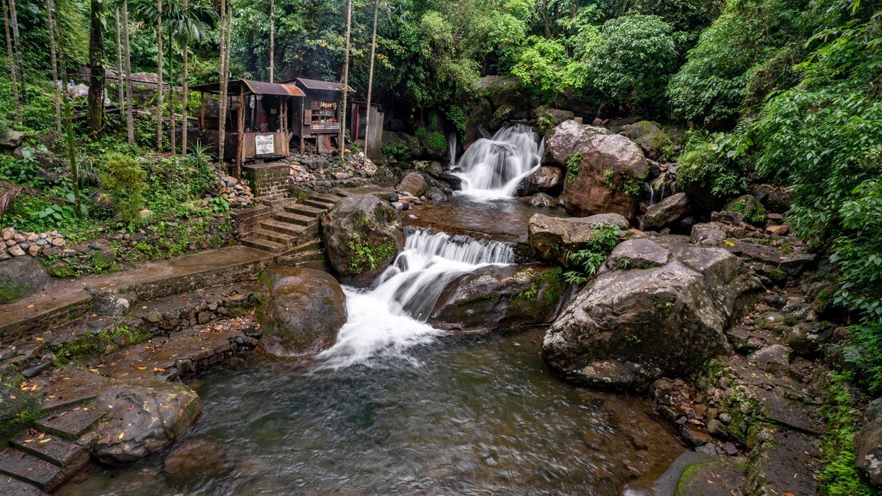
Namdapha Rainforest Trek Guide: The "Amazon of India" & The Four Cat Realm
Japfu Peak Trek Guide: The "Rhododendron Giant" & Valley Watchtower