Rupin Pass Trek Guide: The Ultimate "Crossover" Adventure (Uttarakhand to Himachal)
📍The Mighty Himalayas (North India)
The Summit Summary
- Location: Starts in Dhaula, Uttarakhand and ends in Sangla, Himachal Pradesh.
- The Vibe: A Bollywood-style blockbuster. The scenery changes drastically every single day—from hanging villages and deep pine forests to glacial valleys and a kinetic waterfall climb.
- Difficulty: Moderate to Difficult. This is a notch above treks like Hampta Pass. It involves technical sections (snow bridges, waterfall gully) and high altitude.
- Duration & Variants: 7-9 Days (Standard Itinerary). 52 km Total Distance.
- TrippinAI Recommended Slot: Mid-May to June (For the best snow experience) or September to Mid-October (For sharp views and autumn colors).
- The TrippinAI Rating: "At TrippinAI, we rate this trek a 6.5/10 on endurance (due to the steep, technical ascent through the waterfall gully and the long pass crossing day)."
The Climb: What to Expect
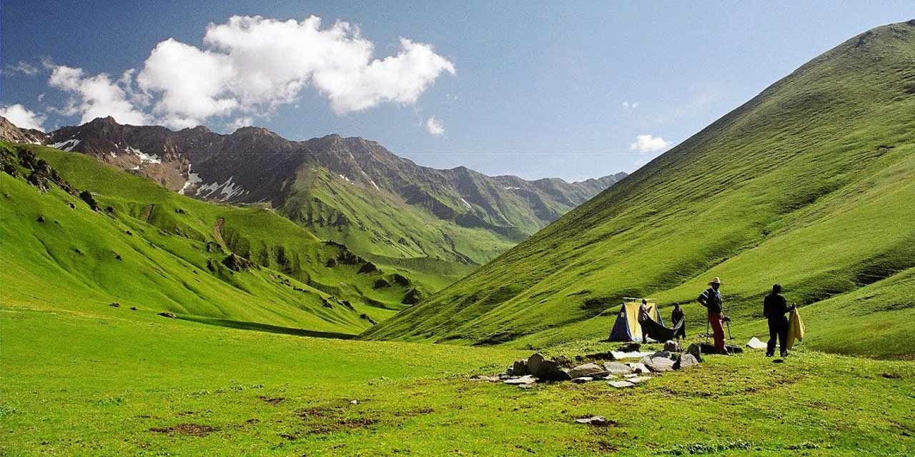
The Reality Check: Rupin Pass is not just a trek; it’s an expedition across state lines. The drama begins at the "U-shaped" valley of Dhanderas Thatch, where you see the infamous three-stage waterfall crashing down from the clouds. Unlike other treks where you walk around obstacles, here you climb through them. You will ascend directly up the waterfall's snowy gully, scrambling over rocks and ice. The climax is the pass itself—a narrow, windy notch at 15,250 ft. One moment you are looking at the lush greenery of Uttarakhand, and after a thrilling 500-meter snow slide down the other side, you land in the rugged, cold desert winds of the Kinnaur valley in Himachal.
Why It's Famous & What Trekkers Say
The Fame Check:
- The "Crossover" Appeal: It is one of the few treks that physically crosses the Himalayan range, taking you from the lush Garhwal culture to the distinct Kinnauri Buddhist culture.
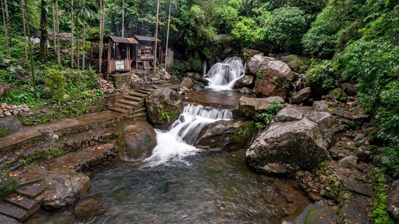
- The "Waterfall" Ascents: The trail is famous for the campsite at the top of a waterfall. You literally sleep on the edge of a precipice with the river roaring beneath you.
The Social Pulse:
- The Good (What Trekkers Love): The unparalleled variety. Users often claim, "It’s like doing three different treks in one." The "Hanging Village" of Jhaka is a favorite for photography.
- The Bad (What Trekkers Hate): The travel logistics. Since the start and end points are different and far apart, arranging transport is expensive and tiring. The "Snow Bridges" can be scary for those afraid of heights.
The Trail: Milestones & Route Map
The Route Breakdown:
- Dhaula: Base Camp (5,100 ft). The Highlight: The trailhead in Uttarakhand. The Rupin river is blue and calm here.
- Sewa & Jhaka: Days 2 & 3. The Highlight:Jhaka, known as the "Hanging Village." It clings to a sheer cliffside and defies gravity. The architecture shifts to intricate wood and stone.
- Dhanderas Thatch: Day 4 (11,680 ft). The Highlight: The lower waterfall campsite. You camp in a vast meadow staring straight up at the massive 1,500 ft waterfall you have to climb the next day.
- Upper Waterfall: Day 5 (13,120 ft). The Highlight: The snow bowl. You are now in the alpine zone, surrounded by glaciers.
- Rupin Pass: Summit Day (15,250 ft). The Highlight: The steep gully climb followed by the "Great Slide"—a fun, controlled slide down the snow slopes on the Himachal side.
- Sangla: End Point. The Highlight: The civilization of Kinnaur. Apple orchards, Buddhist flags, and the road to Shimla.
How to Reach (The Gateway Hubs)
The Navigation Breakdown:
- Gateway Hub (Start): Dehradun (Uttarakhand).
- Gateway Hub (End): Shimla (Himachal Pradesh).
- Start Point:Dhaula (10-hour drive from Dehradun).
- End Point:Sangla (7-hour drive to Shimla).
The TrippinAI Verdict:
- Most Cost Efficient: Train to Dehradun -> Local Bus to Sankri -> Shared Jeep to Dhaula. (Very difficult to coordinate).
- Most Time Efficient: Organized Transport arranged by trek operator. They pick you up at Dehradun Railway Station and drop you at Shimla Old Bus Stand.
- Important Logistics Note: Since you end in a different state, do not book a round-trip ticket to Dehradun. Book your return journey from Chandigarh or Shimla.
Total Budget & Hidden Costs
The Wallet Damage:
- TrippinAI Budget Rating: Premium. (Higher than typical treks due to point-to-point transport logistics).
- Permits: Entry Fee Required. Fees are collected for the Govind Pashu Vihar National Park.
- Trek Package: Expect INR 16,000 - 22,000 per person. The cost is higher because support staff and mules also have to "cross over" and cannot easily loop back.
- Transport Cost: Budget an extra INR 4,000 - 6,000 for the long drives (Dehradun-Dhaula and Sangla-Shimla).
Smart Spending Hacks:
- Hack #1: Book Return from Chandigarh. Don't fly out of Shimla (Jubbarhatti); flights are rare and expensive. Take a bus from Shimla to Chandigarh (3 hours) and fly from there. Save INR 3,000+.
- Hack #2: Group Discounts. Operators love filling slots on this trek because logistics are fixed. A group of 4 can often negotiate 10% off.
- "Use TrippinAI for more accurate and personalized information on costs."
Food & Local Legends
Context:
- The Flavor: In the lower villages (Sewa/Jhaka), try Sidu, a local steamed bread filled with walnut paste or poppy seeds, dipped in ghee.
- Local Insight: The locals of Jhaka believe they are descendants of the Pandavas who stayed here during their exile. The village temple has distinct Kinnauri-style architecture, marking the cultural transition zone.
Seasonality, Safety & Health
Best Time to Visit:
- Summer (May-June): Massive snow. The waterfall gully is frozen, requiring technical climbing (ropes usually fixed by guides). Great for thrill-seekers.
- Autumn (Sept-Oct): The snow melts, revealing the rocky trail. The meadows are golden, and the sky is crystal clear. Better for photography.
Traveler Safety Verdict:
- For Solo Travelers: Recommended with Groups. Do not attempt this solo without a guide. The route finding in the snowfields is tricky, and the pass crossing is technical.
- For Female Travelers: Safe in Groups. The trail is remote, but organized groups are common.
- For Beginners: Not Recommended. The daily distance and the technical ascent at the waterfall make this suitable for trekkers with at least one prior Himalayan trek experience.
Risks & Actionable Mitigation:
- Snow Bridges: You walk over hollow ice tunnels formed by the river. Mitigation: Listen to the Guide. They probe the ice. Never wander off the beaten path on snow bridges; they can collapse.
- Falling Rocks: The gully is narrow, and loose stones fall from above. Mitigation: Helmets are often provided by operators for the gully section. Keep your eyes up and ears open.
- "Check TrippinAI for real-time weather updates."
Getting Trek-Ready
Preparation Tips:
- High Intensity Cardio: You need explosive power for the steep bursts. Include HIIT (High-Intensity Interval Training) in your workout 1 month prior.
- Upper Body Strength: You might need to use your hands to scramble over rocks near the waterfall. Push-ups help.
- Gear Prep: Waterproof Gloves are critical for the snow slide. Woolen gloves will get wet and freeze your fingers.
Expedition Essentials
- Footwear: Technical Trekking Boots with a stiff sole. Soft shoes will bend and fail on the steep snow kicks.
- The "Hero" Item: Microspikes & Gaiters. Usually provided by operators, but having your own ensures fit. Essential for the snow gully.
- Clothing: Quick-dry pants. You will likely slide on snow; denim or cotton will freeze and cause hypothermia.
FAQ: Trekker's Most Asked Questions
Q: Is Rupin Pass safe in July (Monsoon)? A: No. The lower regions (Uttarakhand side) receive heavy rainfall, making the trail to Dhanderas Thatch dangerous due to landslides and slippery mud.
Q: How long is the slide at the pass? A: It is a controlled slide of about 300-500 meters on the snow slopes descending into Himachal. It is safe if you follow instructions (keep legs up, use elbows to brake).
Q: Do I need to carry my backpack? A: You can offload it to a mule (cost approx INR 3,000 for the trek), but we recommend carrying a daypack with water and rain gear.
Planning Rupin Pass? Snow conditions in the gully dictate if the pass is crossable. Static blogs won't tell you if the route is broken. TrippinAI gives you real-time route status and personalized itineraries. [Check Pass Status Now.]
Recommended for You
Namdapha Rainforest Trek Guide: The "Amazon of India" & The Four Cat Realm
Japfu Peak Trek Guide: The "Rhododendron Giant" & Valley Watchtower